


It is the only protected area in Sub-Saharan Africa with internationally significant geological features, and which opens its doors to tourism, conservation, education, and research concerning not just geology but other relevant sciences. Needless to say, this is the only site where tourists from around the world may completely appreciate natural beauty while also learning and conducting research in different fields.
Whether you’re planning a vacation or study trip, consider visiting the Ngorongoro-Lengai UNESCO Global Geopark in Arusha, Tanzania. The Geopark is a popular stopover for visitors to other well-known national parks such as Lake Manyara and the Serengeti. Due to its offering a wide variety of tourism opportunities, it is considered a “must-visit” destination by most travelers, especially those interested in exploring geological wonders such as the Ngorongoro Crater, Lake Natron, and Lake Eyasi.
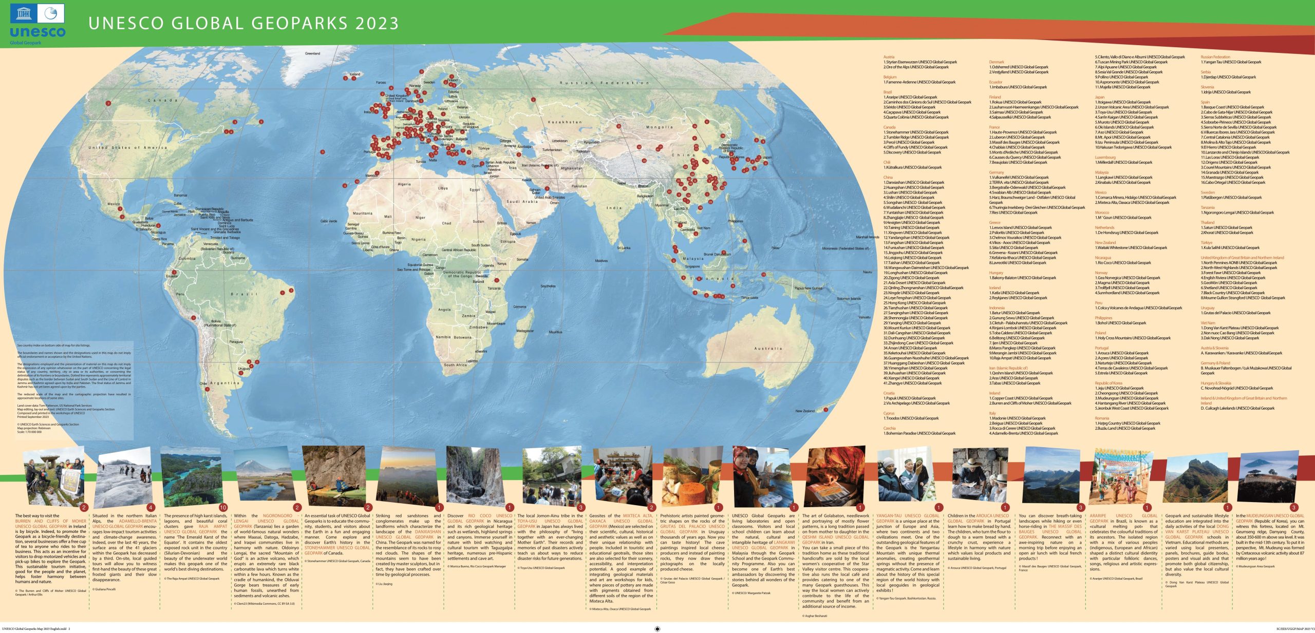
Ngorongoro Lengai Geopark is one of only two global geoparks currently located in Africa (the other is in Morocco) and one of 147 worldwide.
Location
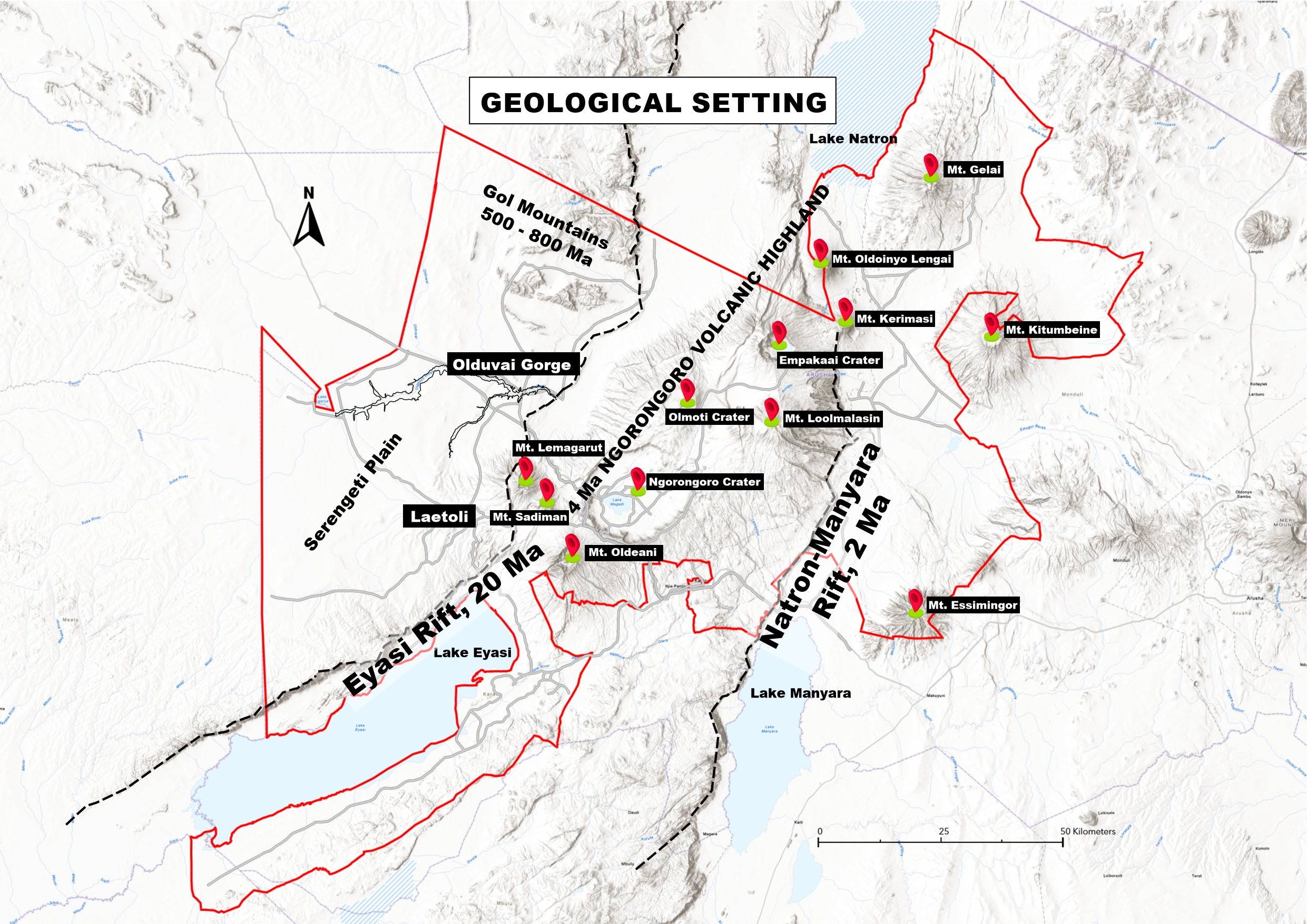
The Geopark is situated in the Northern Circuit of Tanzania (East Africa). It encompasses the Arusha districts of Ngorongoro, Karatu, and Monduli. The Serengeti National Park borders the area to the north and north-west, Lake Natron to the east, the left arm of the Great Rift Valley to the south, and Maswa Game Reserve to the west.
The Geopark spans about 12,000 sq. km (4,634 sq. miles) and has a resident population of around 250,000 people, the vast majority of whom are Maasai.
Cultures
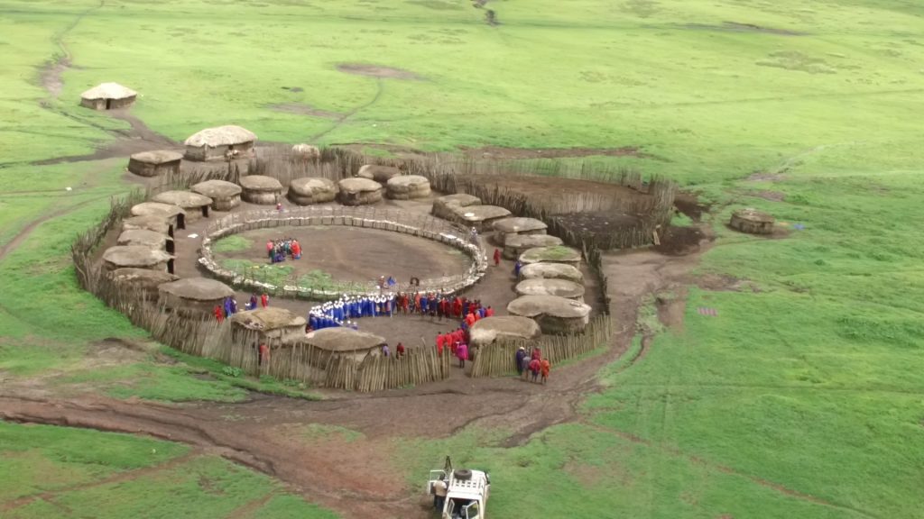
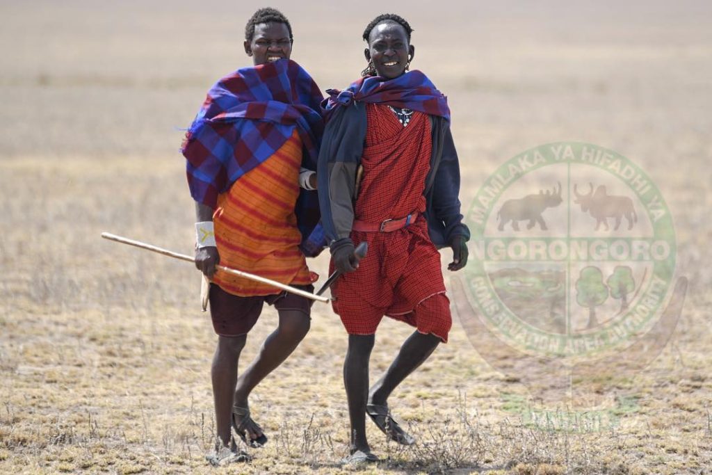
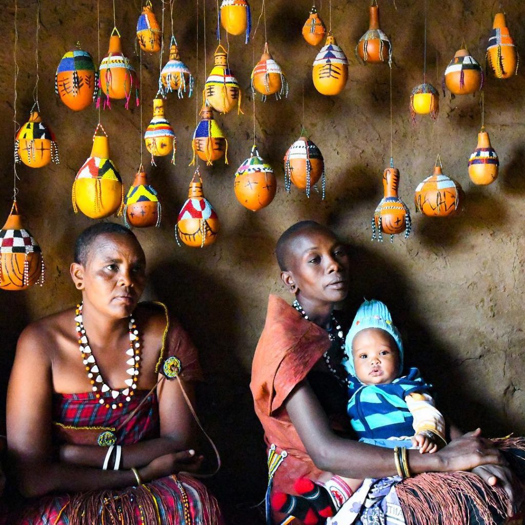
The Ngorongoro-Lengai Geopark is home to multiple ethnic groups; the Maasai being the most prominent, having migrated south-east from the Nile area in the 18th century. Also present are the Datoga, Irawq and Hadzabe Tribes. The Maasai and Datoga are pastoralists, whereas the Irawq are agriculturalists. The Hadzabe, on the other hand, are an indigenous ethnic group who are regarded as hunters-gatherers and are not closely related to any other ethnic group in the area.
These communities’ diverse cultures and cultural heritage are in part a reflection of differences in local plant and animal ecologies, which, in turn, are influenced largely by differences in local geology and weather. The Geopark, in this regard, provides a unique window into the complex interplay of geology, weather, plant life, animal life, and human cultural development.
The Geopark is also well-versed in local heritage and traditional knowledge. Each tribe has its own distinct way of life, which together produce a diverse range of traditional rituals, traditions, tales, songs, and dances.
The North, South, Caldera, and Oldoinyo Lengai Routes are the four “exploration” routes that traverse the Geopark and neighboring areas. Each of these routes requires a full day to complete and has its own unique geological, cultural, and biological features.
Visitors to the Geopark must be accompanied by a certified guide provided by the Ngorongoro Conservation Area Authority.
Professional local guides who can provide further insight and information at specific areas will occasionally join in. Along each route, there are numbered concrete monuments that mark pauses and interpretive panels.
GEO-ROUTES
North Route
The route begins from the south entrance of Ngorongoro Conservation Area at Loduare gate to reach the base of the Gol Mountains at Olkarien Gorge geosite. A unique safari experience in which the Earth history intimately linked with the human history inside wonderful and unique landscapes.
The route travels along the southwestern edge of Ngorongoro Crater before dropping down into the Serengeti Plains region and Olduvai Gorge. It then travels northward into the Gol Mountains, finally ending at Olkarien Gorge. Some of the oldest and youngest rocks in the Geopark are exposed along this route.
Unique features the North Route
The Caldera Route
This route takes one on a one-day tour along the crest of the Ngorongoro Volcanic Highlands. It starts inside Ngorongoro Crater (or caldera), which is the jewel of Ngorongoro Lengai Geopark. The caldera itself is the largest, intact caldera on earth and is home to breath-taking array of animals and plants.
The crater also features sites that are sacred to area indigenous tribes. After leaving the caldera, you will pass by Olmoti and Empakaai volcanoes, both of which also have large craters, and the Loolmalasin Mt. the third highest mountain in Tanzania. At the end of the route, you will be rewarded with a view of Oldoinyo Lengai Volcano.
Unique features the Caldera Route
The South Route
The South Route explores many different cultural sites in the Geopark. It begins in Karatu, on the southern flank of the Ngorongoro Highlands, and weaves southwest from there to regions on the north and east sides of Lake Eyasi.
In addition to visiting several different local tribes and an important agricultural area, the route takes you to see the world-famous Laetoli Footprints.
Unique features the South Route
Oldoinyo Lengai Route
The Oldoinyo Lengai Route begins in Karatu and heads north along the East African Rift Zone to the Oldoinyo Lengai Volcano, Lake Natron, and lastly to the Engaresero Footprint.
The route offers amazing views of the rift escarpment, as well as stops at several unusual volcanic features called maars and tufa towers. Two archeological sites and a refreshing waterfall are also visited along this route.
Unique Features the Oldoinyo Lengai Route
what is your experience at NCAA
chat with our representative
entry fee, motor vehicle, crater fee etc
what is your experience at NCAA
chat with our representative